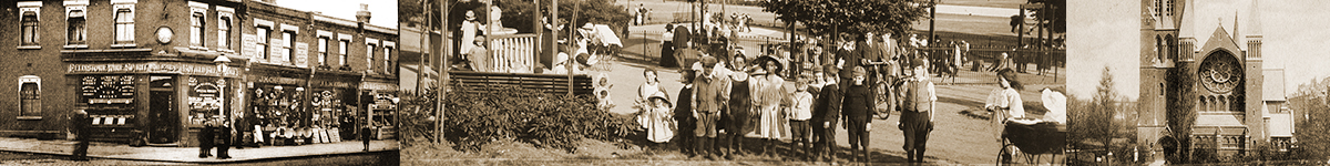
The History of Mapesbury
Mapesbury is generally considered as the triangular area that once had the villages of Willesden Green, Cricklewood and Kilburn at each of its three corners, although its historical origins and current official council definition are somewhat different.
The triangle had been largely used for arable farming since mediaeval times until the building boom started in the very late 19th century. Most of the land had belonged to St Paul’s Cathedral. Mapesbury was the name of one of eight demesne estates of Willesden, from at least the 15th century, with the manor house lying at the southern edge of today’s triangle. It was unusually named after a person rather than an existing placename.
This person was Walter Map (c1140-c1210), a Welsh writer and clergyman. He served King Henry II and was a canon of St Paul’s Cathedral, although he spent more time abroad than he did in England. Henry II of course ruled more than half of France at the time. Walter Map travelled with the court, to France and also as an ambassador to the Vatican Council. He held a prebend in the area from 1173 to 1192, although in practice he may have spent little time here.
Map’s only surviving work is De Nugis Curalium (Trifles of Courtiers). It is a collection of anecdotes and satirical trivia, said to be a blend of fiction and real life stories, that gives some fascinating insights into lives of people in the 12th century.
Mapes Lane was the original name of Willesden Lane, the southern edge of the Mapesbury triangle. The eastern edge, now called Shoot-Up Hill, is a short stretch of the 275-mile-long Roman road previously called Watling Street. By the mid 1800s there was one more named road in Mapesbury: Walm Lane which forms part of the western edge of the triangle, before making a sharp turn across the fields in the centre of Mapesbury manor.
The garden of the manor house is roughly the area between Deerhurst, Chatsworth and Coverdale Roads. Throughout most of the 19th century the manor included stables for nearly sixty horses. The richer people in the surrounding area would hire horses for a day. The horses were also trained for a Mayfair dealer who supplied horses for the gentlefolk to ride in Hyde Park. In 1925 the manor house was demolished and the land divided up into house plots.
An act of parliament in 1840 transferred the land from St Paul’s to church commissioners, who decided it would be profitable to lease the land to developers.
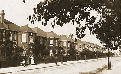
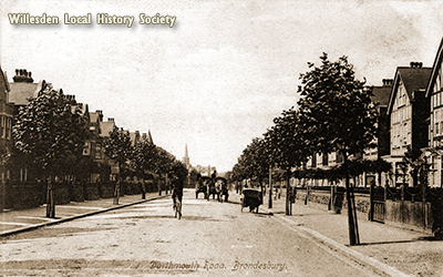
There was a handful of houses on the south-western side of Shoot Up Hill but the building of large brick villas started in earnest in the 1880s, mainly on Exeter Road and in the south-east corner containing Christchurch Road and Mowbray Road. The builders called it “Mapesbury Estate”. It is clear to see which houses were built first, with their less ornate design than the rest of the Mapesbury properties. By 1910 the majority of Mapesbury was full up. The houses, many having gardens of at least 100 feet long, are Edwardian in style, with evidence of influence of the Arts and Crafts movement.
The large houses attracted the middle classes, including some from continental Europe. Most households had servants. Later many properties were divided up into flats.
The Metropolitan Railway, as it was originally called, runs through Mapesbury, with the first trains operating in 1879. The tracks now carry the Jubilee and Metropolitan Line tube trains.
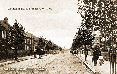
There is evidence of the brief existence of a football ground in the late 1890s on Dartmouth Road, where official league matches were played.
Some of the roads, namely Teignmouth, Dartmouth, Dawlish, Lydford and Exeter are named after small towns in the county of Devon. Chatsworth Road has no counterpart in Devon but it is thought there may be a link to the Duke of Devonshire, who owns Chatsworth House in Derbyshire. Sheldon is also a village in Devon but a more convincing theory is that Sheldon Road was name after a Fellow of All Souls College, Oxford, who owned the land at the northern tip of the triangle.
There was once a mill called Mapesbury Mill, and its accidental destruction by fire in 1863 led to the creation of a new local volunteer fire service.
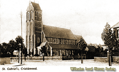
Other significant landmarks in Mapesbury include St Gabriel’s Church, a Grade II listed building consecrated in 1897 and still active. Another church was St George’s, built in 1888 on Willesden Lane and used as a military hospital during WWI. But the congregation diminished rapidly and the building was demolished in 1986. The site now hosts the Shree Swaminaryan Temple.
Another splendid church was the non-conformist Wesleyan Chapel at the corner of Dartmouth Road and Walm Lane. It opened in 1899 but was damaged by war, and is now replaced by the residential flats called Westly Court.
The Queensbury pub on Walm Lane was built in 1893 as a doctor’s surgery. The property was later owned and used by the local Conservative Club before its makeover as a public house. The pub is sadly currently earmarked for demolition, to make way for the construction of modern flats, despite a campaign of many years to save it.
There is also a little park, called Mapesbury Dell. In 2005 this space was transformed by the local community from an ugly wasteland frequented by drug users to a delightful pocket park with a pond and a children’s play area.
Finally, a bowling green was built in in the 1890s, and is still operating.
Most of the Mapesbury triangle is now a conservation area. Brent council’s current definition of the ward of Mapesbury extends north-westwards to create a much bigger area. However, it now excludes the area to the south of the railway line, i.e. all of Chatsworth Road and the original site of Mapesbury Manor House.
Hester Coley – February 2021
See also: Mapesbury House, Brondesbury by Dilwyn Chambers in Journal 20, available as a pdf download in the Archive section, which is the WLHS members area (coming soon)